USGS-HVO Update on Kīlauea, January 4th 2021
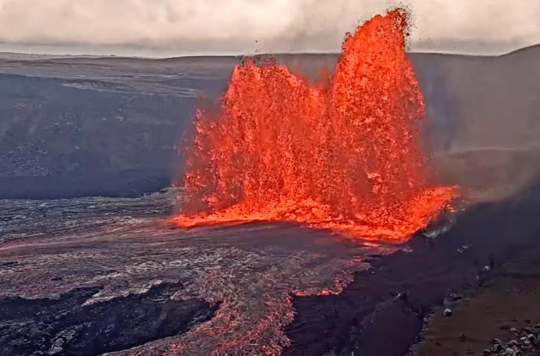
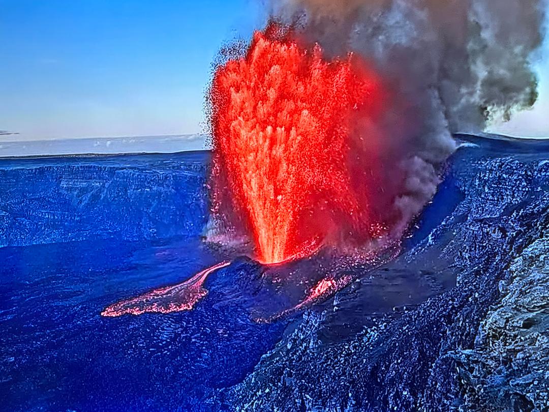
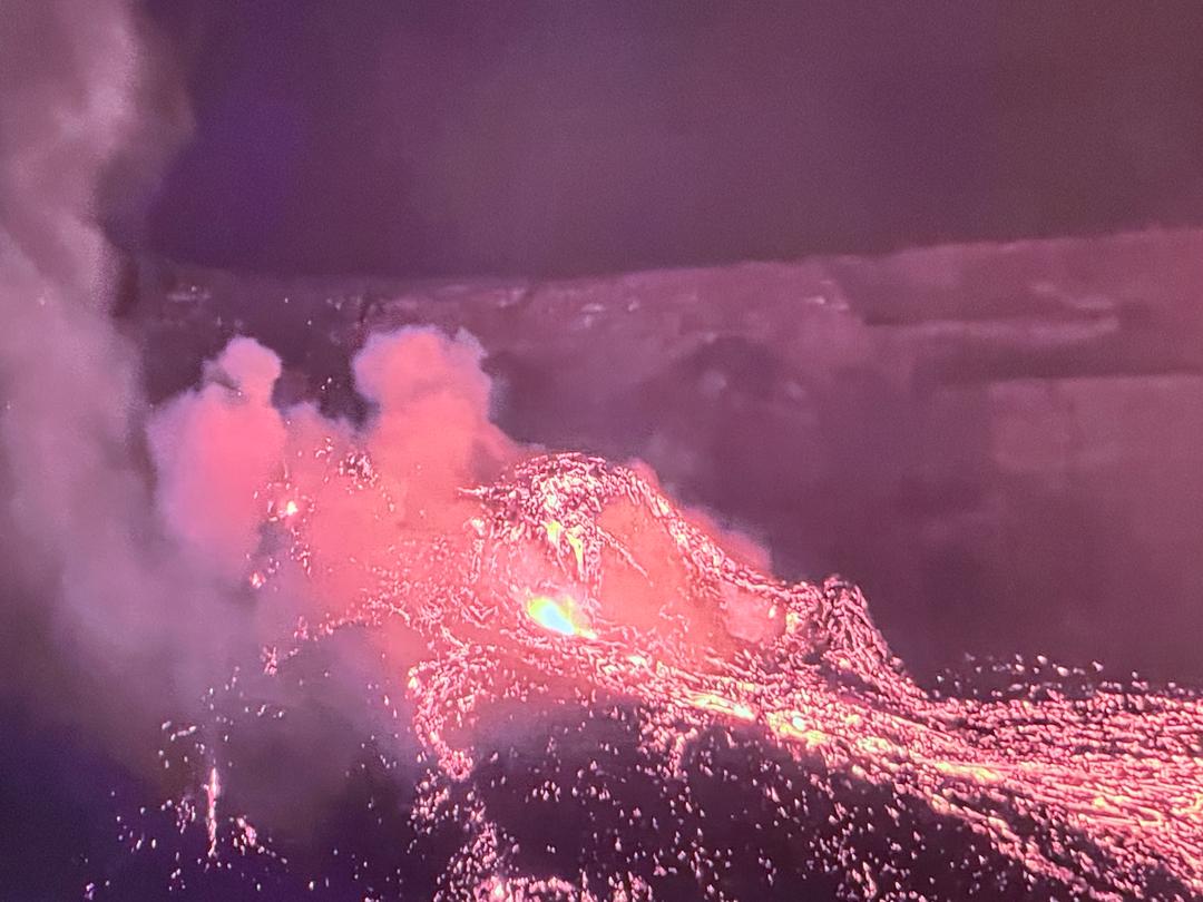
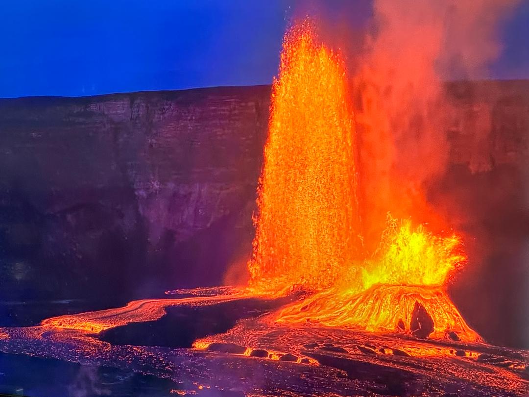
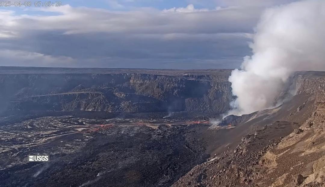
Activity Summary: Lava activity is confined to Halemaʻumaʻu with lava erupting from vents on the northwest side of the crater. Yesterday afternoon (Jan. 3), the lava lake was 190 m (623 ft) deep and perched about a meter (yard) above its edge. SO2 emission rates were still elevated. Summit Observations: Sulfur dioxide emission rate measurements made Friday (Jan. 1) were about 4,400 t/d and in the range 3,000-6,500 t/d since Sunday (Dec. 27)--the same range of values that was common for emissions from the pre-2018 lava lake. Summit tiltmeters recorded weak deflationary tilt over the past three days. Seismicity remained elevated but stable, with steady elevated tremor and a few minor earthquakes. East Rift Zone Observations: Geodetic monitors indicate that the upper portion of the East Rift Zone (between the summit and Puʻu ʻŌʻō) contracted while the summit deflated at the onset of this eruption. There is no seismic or deformation data to indicate that additional magma is currently moving into either of Kīlauea’s rift zones. Halemaʻumaʻu lava lake Observations: The west vents spattered from two places at the top of a small cone plastered on the northwest wall of Halemaʻumaʻu crater. Lava is also emerging as a small dome fountain in front of the west vents probably from a submerged portion of the vent. Both of these sources can be seen in the thermal webcam view of the lava lake. The lava lake was 190 m (623 ft) deep Sunday afternoon (Jan. 3) and had a volume of 26 million cubic meters (34 million cubic yards). The most recent thermal map (Dec. 30) provided the lake dimensions as 800 by 530 m (875 by 580 yds) for a total area of 33 ha (82 acres) (https://www.usgs.gov/maps/december-30-2020-k-lauea-summit-eruption-thermal-map). The lake is now perched about a meter (yard) above its narrow edges as measured yesterday morning (Jan. 3); overflows onto the narrow edge slowly elevated a low wall around the lake similar to an above-ground swimming pool. The main island of cooler, solidified lava floating in the lava lake continued settling in front of the west lava source filling the lake, while the other 10 or so small islands moved a bit around the east end of the lake. The main island measured about 250 m (820 ft) in length, 135 m (440 ft) in width, and about 3 ha (7 acres) in area based on the Dec. 30 thermal map. Measurements Friday afternoon (Jan. 1) showed that the island surface was about 6 m (20 ft) above the lake surface. Near-real time webcam views of the lava lake can be found here: https://volcanoes.usgs.gov/volcanoes/kilauea/multimedia_webcams.html. KILAUEA VOLCANO (VNUM #332010) 19°25'16" N 155°17'13" W, Summit Elevation 4091 ft (1247 m) Current Volcano Alert Level: WATCH Current Aviation Color Code: ORANGE Images and captions from USGS: - Image 1: At Halema‘uma‘u, the west vents (visible in the foreground of this photo as two glowing holes on a cone-shaped feature) erupt occasional spatter. Lava is also emerging in a small dome fountain above the lake crust in front of the west vents, probably from a submerged portion of the vent (visible in the background of this photo as a bright spot with lava crust boundaries emanating from it like a spider web). These processes can be observed in Kīlauea Volcano's summit F1 thermal webcam view of the lava lake. USGS photo by H. Dietterich. - Image 2: Early this morning, the west vents in Halema‘uma‘u spattered from two places at the top of a small cone plastered on the northwest wall. This process can be seen in Kīlauea Volcano's summit F1 thermal webcam view of the lava lake. USGS photo by H. Dietterich. - Image 3: Western fissure lava lake inlet showed low fountaining. Very weak spatter at western vent. Only minor seismic activity observed at summit. The large island in Kīlauea's summit lava lake has drifted closer to the west vent area, where a dome fountain has become more vigorous in the past day. USGS photo by K. Lynn. - Image 4: Halema‘uma‘u lava lake develops ~1-yd-high levee along east & west perimeter (on right & left), allowing lake to be "perched" above base. Levees grow from repeated small overflows & pieces of surface crust that fuse together into a barrier that impounds fluid lake.