A New Eruption of Kīlauea Volcano In Hawaii Has Commenced
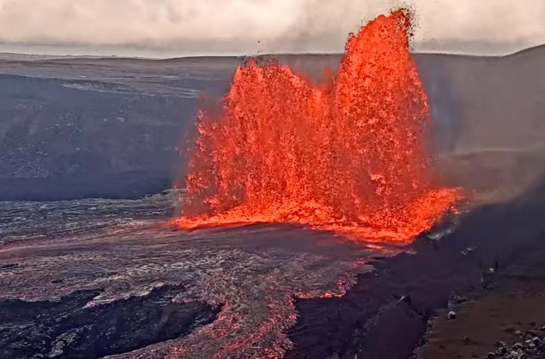
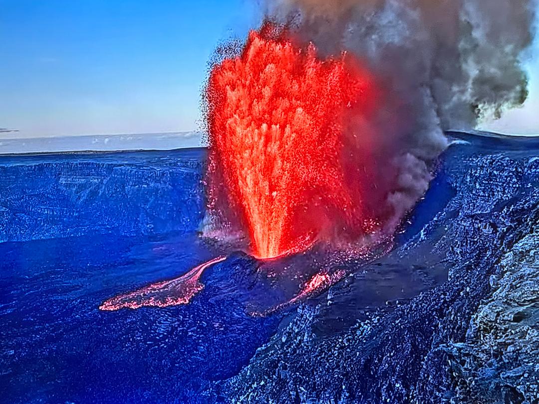
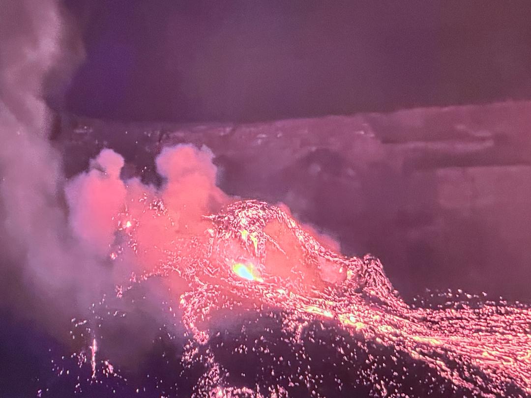
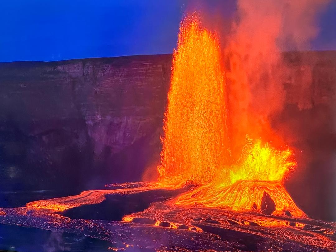
(HVO-USGS) Shortly after approximately 9:30 p.m. HST, the USGS Hawaiian Volcano Observatory (HVO) detected glow within Halemaʻumaʻu crater at the summit of Kīlauea Volcano. An eruption has commenced within Kīlauea’s summit caldera. The situation is rapidly evolving and HVO will issue another statement when more information is available. Observations - Recent Observations: For the past several weeks, the USGS Hawaiian Volcano Observatory (HVO) has recorded ground deformation and earthquake rates at Kīlauea Volcano’s summit and upper East Rift Zone that have exceeded background levels observed since the conclusion of the 2018 lower East Rift Zone eruption and summit collapse. Beginning in September 2020, increased rates of uplift were observed by GPS stations in Kīlauea’s upper East Rift Zone. In the past month, increased uplift has also been measured at GPS stations in Kīlauea’s summit region. While uplift related to post-collapse inflation of the summit reservoir has been occurring since March of 2019, rates have been steadily increasing in recent months and are currently higher than they have been since the end of the 2018 eruption. In late November 2020, increased earthquake rates began when seismic stations recorded an average of at least 480 shallow, small-magnitude earthquakes (97% of which were less than or equal to magnitude-2) per week occurring at depths of less than 4 km (2.5 miles) beneath Kīlauea's summit and upper East Rift Zone. This compares to a rate of fewer than 180 per week following the end of Kīlauea’s 2018 eruption and through early November 2020. On December 2, 2020, GPS stations and tiltmeters recorded a ground deformation event at Kīlauea’s summit. Accompanied by earthquake swarms, the patterns of ground deformation observed were consistent with a small dike intrusion of magma under the southern part of Kīlauea caldera. The injection resulted in about 8 cm (3 inches) of uplift of the caldera floor, and modeling suggests that it represented 0.4–0.7 million cubic meters (yards) of magma accumulated approximately 1.5 km (1 mile) beneath the surface. Though the intrusion did not reach the surface and erupt, it represented a notable excursion from trends observed in Kīlauea summit monitoring data streams following the end of the 2018 eruption. On December 17, 2020, seismometers detected a notable increase in occurrence and duration of long-period seismic signals beneath Kīlauea’s summit, which are attributed to magmatic activity. Whereas this type of seismicity was observed on average once every few weeks following the 2018 eruption, rates have increased to over a dozen in the past several days. Other monitoring data streams including volcanic gas and webcam imagery were stable until this eruption. An earthquake (4.4) swarm began on the evening of December 20, accompanied by ground deformation detected by tiltmeters. An orange glow was subsequently observed on IR monitoring cameras and visually beginning approximately 21:36 HST. Photos (First) Steam rises high into the night sky as lava quickly overtakes the water lake inside Halema'uma'u crater in Volcano's National Park. Photo by Janice Wei (Second) Red spots are the approximate locations of vents feeding lava flowing into the bottom of Halema‘uma‘u crater. The water lake has been replaced with a growing lava lake. The easternmost vent is currently exhibiting fountains up to approximately 50 m (164 ft) high. (Third)Lava has cascaded into the summit water lake, boiling off the water and forming a new lava lake. The northern fissure, pictured, was producing the tallest lava fountain at roughly 50 m (165 ft), and all lava was contained within Halemaʻumaʻu crater in Kīlauea caldera. (Fourth) Live view inside Halema'uma'u crater. https://www.nps.gov/media/webcam/view.htm?id=5B6292AF-D3C2-CF49-C128FA9697DF00B6

Philip Ong and Dane DuPont went live in our FB group to talk about the new eruption tonight - https://www.facebook.com/groups/hawaiitracker/permalink/1801864043312739/
Dec 21, 2020